

Hocking Hills State Park

Doc approves these ads.

Doc approves these ads.

Doc approves these ads.
Find Another Park – About – Maps – Tags – Trails – Waypoints – Links – Blogs
About
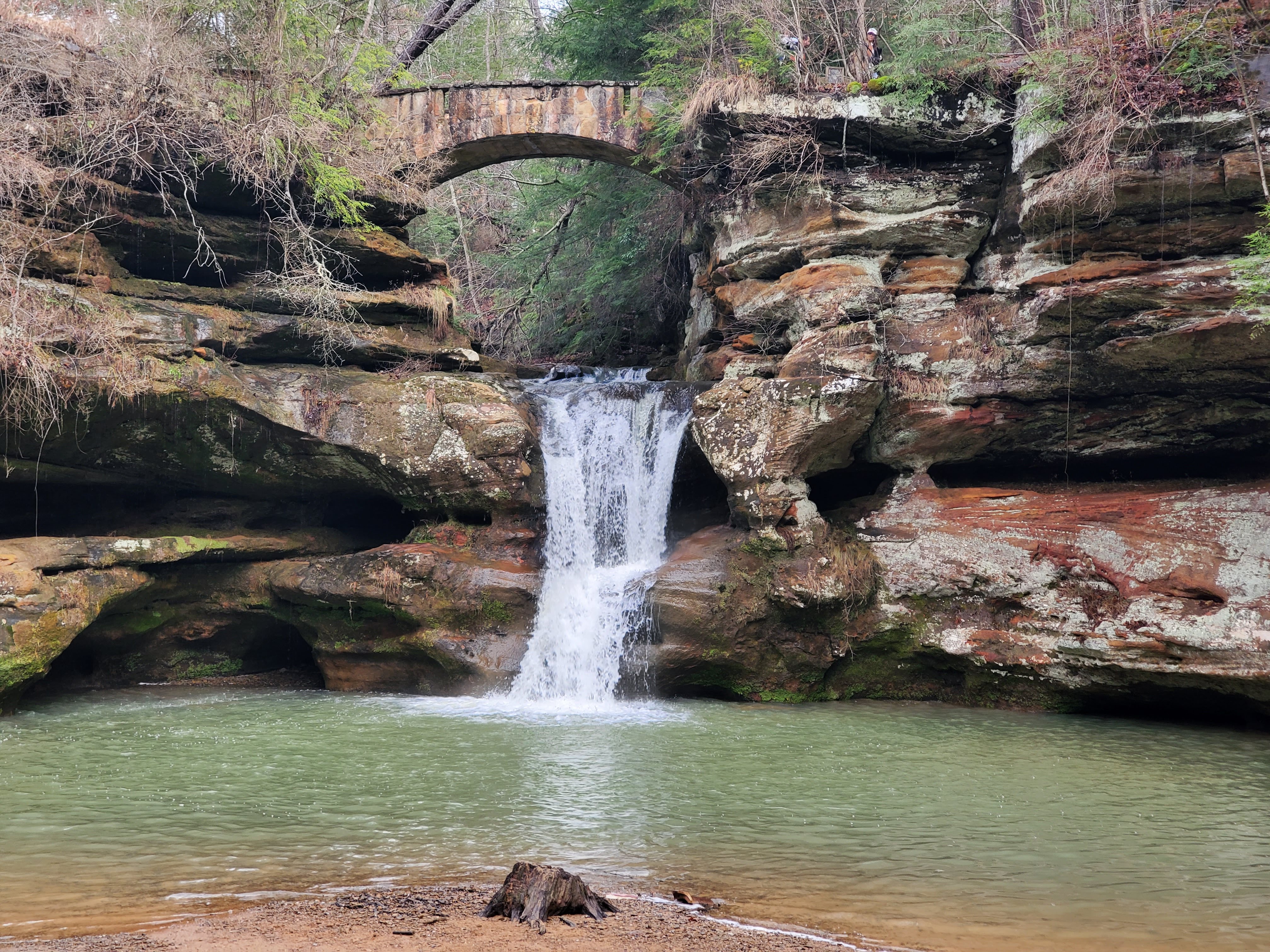
Hocking Hills State Park is mix of areas in a vast area known as the Hocking Hills Region. The landscape and flora and fauna are some of the most amazing and diverse in the state. Towering cliffs, waterfalls, wildflowers, and caves dominate this area. Hocking Hills State Park is actually composed of six distinct areas scattered around the region with a State Forest and a State Nature Preserve often included in literature. There is a campground, cabins, lodge, visitor center, and miles of trails, along with all of the natural features mentioned above.
I’ve included resource pages for each of the individual areas below:
- Old Man’s Cave
- Whispering Cave
- Ash Cave
- Rock House
- Cantwell Cliffs
- Conkles Hollow State Nature Preserve
- Hocking State Forest
- Cedar Falls

Resource ID: 131
Name: Hocking Hills State Park Resource Type: Park Google Map Location: 39.43366172, -82.54827697 Official Website: https://ohiodnr.gov/wps/portal/gov/odnr/go-and-do/plan-a-visit/find-a-property/hocking-hills-state-parkFind Another Park – About – Maps – Tags – Trails – Waypoints – Links – Blogs
Maps
Find Another Park – About – Maps – Tags – Trails – Waypoints – Links – Blogs –Images
Tags (Similar Parks)
Camping, Caves, Cliffs, Hiking, Historic Site, Lake, Lodge, Nature Center, Prairie, Spring Wildflowers, Summer Wildflowers, Trails, Waterfalls, Woods,
There are more tags in the related areas. I’ve included resource pages for each of the individual areas in the Links.
Find Another Park – About – Maps – Tags – Trails – Waypoints – Links – Blogs
Trails
- Gorge Overlook Trail – Cedar Falls, Old Man’s Cave – 2.8 miles, point-to-point, medium difficulty, dirt, pets allowed, very easy compared to the lower gorge trail between Old Man’s Cave and Cedar Falls.
- Trailhead 1 – Cedar Falls – Link – 39°25’06.8″N – 82°31’31.4″W
- Waypoint Marker FF – Cedar Falls Parking 1 – Link – 39°25’09.3″N – 82°31’26.5″W
- Waypoint Marker EE – Rose Lake Dam – Link – 39°25’28.6″N – 82°32’14.0″W
- Rose Lake Dam – Link – 39°25’30.0″N – 82°32’17.0″W
- Waypoint Marker DD – Camp Connector – Link – 39°25’31.4″N – 82°32’19.8″W
- Waypoint Marker CC – Camp Trail 2 – Link – 39°25’52.9″N – 82°32’36.4″W
- Waypoint Marker BB – Camp Trail 1 – Link – 39°26’01.0″N – 82°32’27.0″W
- Waypoint Marker AA – Trailhead 2 – Link – 39°26’12.1″N – 82°32’18.1″W
- Campground to Rose Lake Connector Trail – Old Man’s Cave – 0.1 miles, point-to-point, medium difficulty, gravel and dirt, pets allowed, from Rose Lake to the group area of the campground near the pool.
- Camp Access Trail 2 – Old Man’s Cave – 0.1 miles, point-to-point, medium difficulty, dirt, pets allowed, very steep hill, from non-electric branch of the campground toward the Gorge Overlook Trail.
- Camp Access Trail 1 – Old Man’s Cave – 0.1 miles, point-to-point, medium difficulty, dirt, pets allowed, very steep hill, from entrance of the campground toward the Gorge Overlook Trail and the Visitor Center.
- Gorge Trail – Ash Cave – 0.25 miles, point-to-point, easy difficulty, concrete, pets allowed, wheelchair accessible up to the edge of the cave, flat.
- Rim Trail – Ash Cave – 0.25 miles, point-to-point, medium difficulty, dirt, pets allowed, stairs out of cave, downhill back toward entrance.
- Cedar Falls Trail – Cedar Falls – 0.25 miles, point-to-point, medium difficulty, dirt, pets allowed, To the Falls from the Grandma Gatewood Trail.
- Broken Rock Falls Trail – Old Man’s Cave – 0.2 miles, point-to-point, medium difficulty, dirt, rocks, pets allowed, there are some rocks at the end climb down to base of falls.
- Grandma Gatewood Trail – Old Man’s Cave, Cedar Falls, Ash Cave – 5.2 miles, point-to-point, difficult difficulty, dirt, rocks, pets allowed, long trail connecting all three areas, mostly dirt, with a few rocky climbs, also part of the Buckeye Trail.
- Gorge Overlook Trail – Old Man’s Cave, Cedar Falls – 2.8 miles, point-to-point, medium difficulty, dirt, pets allowed, easier than the Grandma Gatewood Trail between the two areas.
- Upper Falls Loop Trail – Old Man’s Cave – 0.5 miles, loop, medium difficulty, dirt pavement, pets allowed, This loop shares a couple other trails. There are stairs and some hefty climbs.
- Unnamed Connector Trail – Old Man’s Cave – 0.1 miles, point-to-point, easy difficulty, paved, pets allowed, Connects the Old Man’s Cave Trails to the Campground Store.
- Visitor Center Access Trail – Old Man’s Cave – 0.1 miles, point-to-point, medium difficulty, stairs and dirt, pets allowed, Connects the Visitor Center to the Grandma Gatewood Trail.
- Gorge Exit Trail – Old Man’s Cave – 0.4 miles, point-to-point, medium difficulty, stairs and dirt, pets allowed, From Old Man’s Cave and across the rim toward the Visitor Center.
- Lower Falls Access Trail – Old Man’s Cave – 0.1 miles, point-to-point, difficult difficulty, stairs and dirt, pets allowed, Brutal climb out of the lower gorge to the rim.
- Old Man’s Cave to Whispering Cave Connector Trail – Old Man’s Cave – 1.2 miles, point-to-point, easy difficulty, pavement and dirt, pets allowed,
- Hemlock Bridge Trail – Old Man’s Cave – 1 mile, point-to-point, medium difficulty, dirt, pets allowed, Some climbs and along cliffs between the swinging bridge and the Disc Golf Course by the Lodge..
- Whispering Cave Trail – Old Man’s Cave – 0.25, point-to-point, medium difficulty, dirt, pets allowed, From the Hemlock Bridge Trail which leads to the Lodge to the Cave.
- Rose Lake Trail – Old Man’s Cave – 1.5 miles, loop, medium difficulty, dirt, pets allowed, Around Rose Lake.
- Group Camp to Rose Lake Connector Trail – Old Man’s Cave – 0.5 miles, point-to-point, medium difficulty, dirt, pets allowed,
- Campground to Rose Lake Headwaters Trail – Old Man’s Cave – 0.5 miles, point-to-point, medium difficulty, dirt, pets allowed, From the Playground in the Campground to Rose Lake opposite the dam.
The trails are broken down in the related areas. I’ve included resource pages for each of the individual areas in the Links. Also see Waypoints or Maps for more Points of Interest and GPS coordinates.
Find Another Park – About – Maps – Tags – Trails – Waypoints – Links – Blogs
Waypoints
There are more waypoints in the related areas. I’ve included resource pages for each of the individual areas in the Links. Also see Trails or Maps for Trailheads.
Find Another Park – About – Maps – Tags – Trails – Waypoints – Links – Blogs
Links
- Doc’s Maps – Hocking Hills State Park – Google Maps
- External – Official Site: Hocking Hills State Park
- External – Camping Reservations: Reserve Ohio
- External – Lodge and Cabin Reservations: Hocking Hills Lodge and Conference Center
- External – Buckeye Trail
- Doc’s Resources – Conkles Hollow State Nature Preserve
- Doc’s Resources – Hocking State Forest
There are more links in the related areas.
Find Another Park – About – Maps – Tags – Trails – Waypoints – Links – Blogs
Blogs
- Relaxing Winter Weekend with Icy Waterfalls in The Hocking Hills
- Awesome Ice Formations and Single Digit Temps at the Hocking Hills Winter Hike 2024
- 20230401 – Hocking Hills State Park – Rock House
- 20220709 – Hocking Hills State Park
- YouTube: 20220709 – Hocking Hills State Park
- 20220115 – Hocking Hills State Park – Winter Hike
- 20220116 – Hocking Hills State Park – Cottage
- 20201024 – Conkles Hollow State Nature Preserve
- 20201023 – Hocking Hills State Park – Rose Lake, Gorge Overlook, and Grandma Gatewood Trails
- 20190901: Hocking Hills – Short Hike around Old Man’s Cave
- 20190831: Hocking Hills – Campground to Airplane Rock Out and Back
- 20190830: Hocking Hills – Cantwell Cliffs
- 20190830: Hocking Hills – Rock House
- 20190830: Hocking Hills – Conkles Hollow Gorge Trail
- 20190829: Hocking Hills – Campground
- 20190824: Hocking Hills – Old Man’s Cave, Cedar Falls, and Ash Cave Loop
- 20190823: Hocking Hills – Conkles Hollow Rim Trail
- 20190823: Hocking Hills – Old Man’s Cave and Whispering Cave Loop
- 20190822: Hocking Hills – Arrival at The State Park Campground
- 20190705: Old Man’s Cave to Cedar Falls in Hocking Hills, Ohio
There are more blogs in the related areas. I’ve included resource pages for each of the individual areas in the Links.
Find Another Park – About – Maps – Tags – Trails – Waypoints – Links – Blogs
Doc approves these ads.
Doc approves these ads.
Leave a Reply