

Conkle’s Hollow State Nature Preserve

Doc approves these ads.

Doc approves these ads.

Doc approves these ads.
Find Another Park – About – Maps – Tags – Trails – Waypoints – Links – Blogs
About
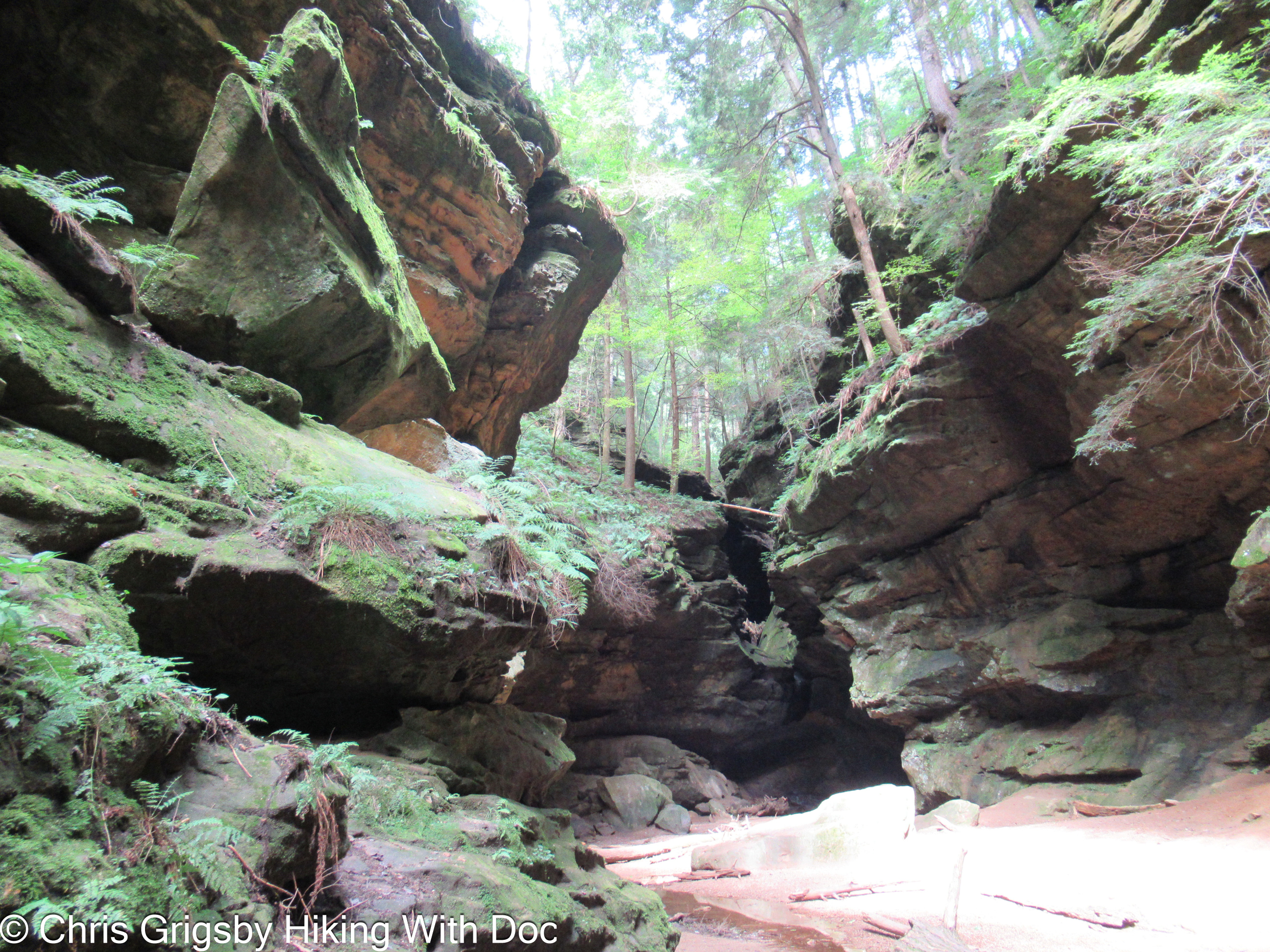
Conkles Hollow State Nature Preserve is one of my favorite places in Ohio. It is managed as a part of Hocking Hills State Park as well as being a State Nature Preserve itself. The short and easy Gorge Trail makes you feel like you are in another world and the Rim Trail has some spectacular views while being quite challenging. The wildflowers in the spring are amazing here as well with some rare species. There are several overlooks along the rim. The gorge is narrow starting at a few hundred feet at the mouth to less than 50 feet at the head with cliffs towering nearly 200 feet overhead and a sizeable waterflow at the end along with several other waterfalls along the trail. About three quarters of the Gorge Trail is paved and flat, making it wheel chair accessible. Please stay on the trail as trampling on anywhere else could damage some of the rare plants or animals that make this place home. The spring wildflowers are also a real treat.
Dogs are NOT allowed on these trails as no pets are allowed in any Ohio State Nature Preserve. This is for the protection of the rare species which live in this delicate environment. Please adhere to this policy or it could result in a hefty fine for breaking the law.
Resource ID: 65
Name: Conkle’s Hollow State Nature Preserve Resource Type: Park Google Map Location: 39.45772049, -82.57636566 Official Website: https://ohiodnr.gov/wps/portal/gov/odnr/go-and-do/plan-a-visit/find-a-property/conkles-hollow-state-nature-preserveFind Another Park – About – Maps – Tags – Trails – Waypoints – Links – Blogs
Maps
Find Another Park – About – Maps – Tags – Trails – Waypoints – Links – Blogs –Images
Tags (Similar Parks)
Accessible Trails, Birding, Caves, Cliffs, Easy Trails, Geologic, Hiking, Moderate Trails, Nature Trails, Picnic Areas, Pit Toilets, Rare Plants, Spring Wildflowers, Streams, Trails, Waterfalls, Woods,
Find Another Park – About – Maps – Tags – Trails – Waypoints – Links – Blogs
Trails
- Gorge Trail – Conkles Hollow SNP – 2.0 miles, loop, Hard difficulty, dirt, rock, no pets allowed, Dangerous cliffs and steep climbs,
- Rim Trail – Conkles Hollow SNP – 0.6 miles, point-to-point, easy difficulty, paved, dirt, rock, no pets allowed, Handycap accessible with level boardwalk and sidewalk most of the way to the falls. Dirt and rock scrambles to get to the falls.
Also see Waypoints or Maps for more Points of Interest and GPS coordinates.
Find Another Park – About – Maps – Tags – Trails – Waypoints – Links – Blogs
Waypoints
- Parking – N39.45319° W82.57247°
- Trailhead – N39.45349° W82.57346°
- Gorge – Diagonal Cave – N39.45788° W82.57555°
- Gorge – Lower Falls – N39.46050° W82.57892°
- Gorge – Reckworth Falls – N39.46018° W82.57799°
- Gorge – The Grotto – N39.45832° W82.57698°
- East Rim – Overlook 1 – N39.45655° W82.57381°
- East Rim – Overlook 2 – N39.45680° W82.57412°
- East Rim – Overlook 3 – N39.45689° W82.57478°
- East Rim – Overlook 4 – N39.45819° W82.57575°
- East Rim – Overlook 5 – N39.45935° W82.57691°
- East Rim – Stairs – N39.45425° W82.57318°
- West Rim – Unnamed Cave – N39.45977° W82.57941°
- West Rim – Stairs – N39.45411° W82.57504°
Find Another Park – About – Maps – Tags – Trails – Waypoints – Links – Blogs
Links
Find Another Park – About – Maps – Tags – Trails – Waypoints – Links – Blogs
Blogs
Find Another Park – About – Maps – Tags – Trails – Waypoints – Links – Blogs
Doc approves these ads.
Doc approves these ads.
Leave a Reply