



Date: 08/24/2019 – Distance: 11.9 mi – Elapsed Time: 7 hrs – Ascent: 1526 ft – Descent: 1511 ft – Difficulty: Hard
Today was going to be a big hike. My goal was to make it to Ash Cave, which I knew was going to be a monumental hike.

I began by heading down the northern campground access trail which leads to the Gorge Overlook Trail. From there I went across the A-Frame Bridge, took an immediate left, and went down into Old Man’s Cave.


I booked it through the cave area and along the Grandma Gatewood Trail toward Cedar Falls.


About three miles from Old Man’s Cave on the Grandma Gatewood Trail you arrive at Cedar Falls.


After spending a bit admiring the waterfall, I backtracked a little and took the steep access trail which leads to the picnic and parking area.

I took a pause at the picnic area and got up my nerve to make the trek to Ash Cave. I found the Ash Cave Trail, which is actually a continuation of the Grandma Gatewood Trail, on the southeast corner near the exit from the main parking area. It looks like a fire access road, so it’s wide and has crushed limestone.

You are actually leaving the State Park and entering State Forrest land until you get to Ash Cave.


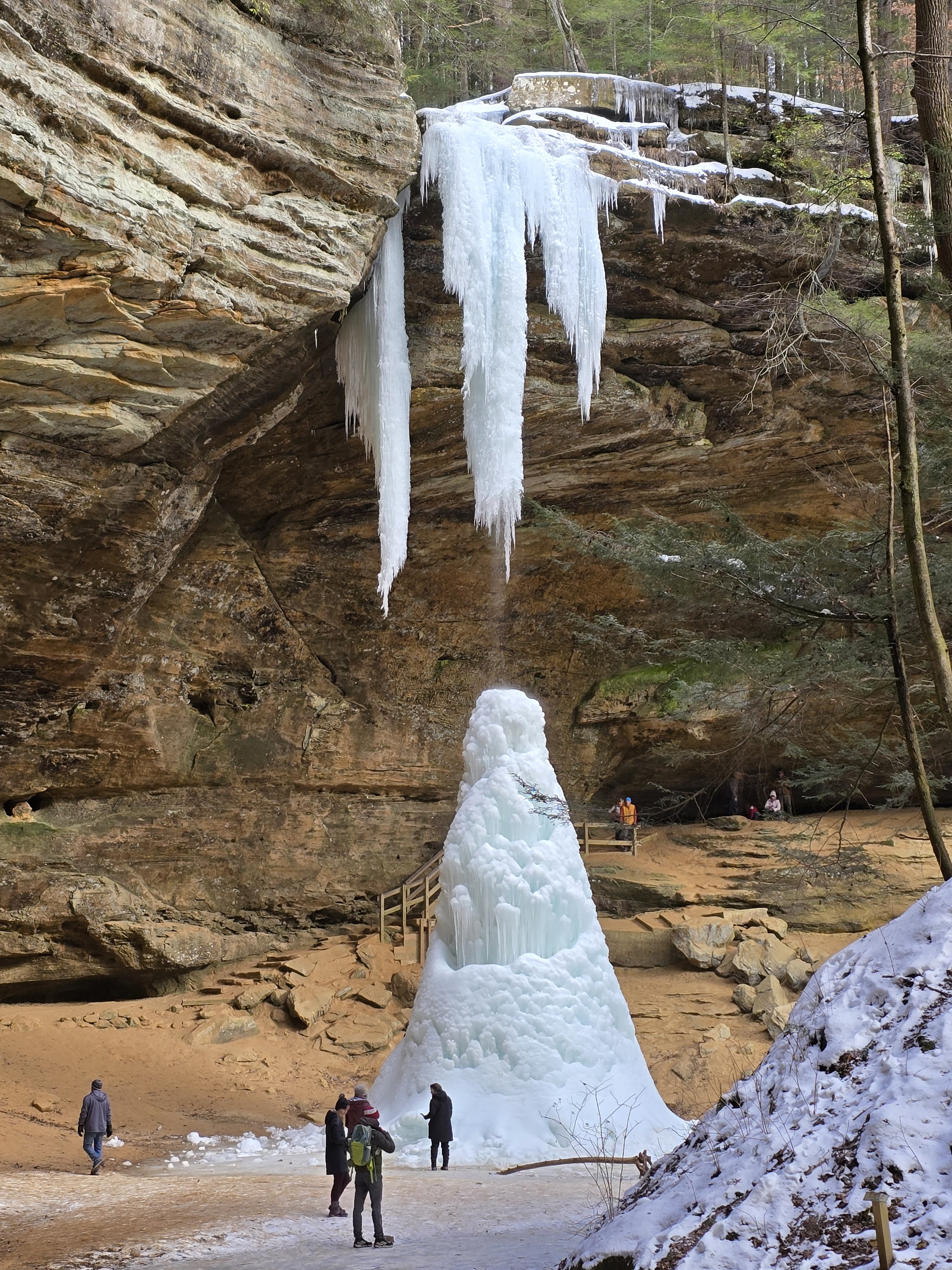
Ash Cave is amazing. Supposedly it is the largest recess cave east of the Mississippi. It too was crowded, but being so large, it isn’t hard to find a quiet spot. I found a bench where I re-energized with a Cliff Bar and water before Heading back. My GPS said I had hiked 7.4 miles so far.


From Ash Cave, I backtracked to Cedar Falls. About half way to Cedar Falls there is a fire tower. I didn’t go up, because I was tired.

At the Cedar Falls picnic area, I then looked for way around falls to Gorge Overlook Trail. Had to take road since trail closed. They wanted me to go down then up, following the Cedar Falls Trail. Due to the climb that would entail, that wasnt happening if I could help it. I decided to try road using my GPS to get to the smaller parking lot above the falls. It was a little dangerous, but I found the smaller parking lot on 374 and the trailhead for the Gorge Overlook Trail.
Dramatic bridge over creek feeding Cedar Falls on Gorge Overlook Trail. There used to be a grist mill here at the top of Cedar Falls.


The Gorge Overlook Trail is very level with lots of Hemlock Groves.

There is a steep climb toward Rose Lake, but when you arrive at the lake, it’s dramatic.


I could have taken the Camp Access Trail at the other end of the dam which would have taken me to the Group Camping area of the campground, however I continued along the Gorge Overlook Trail instead.


I decided to try the other Camp Access trail which leads to the non-electric sites. The waypoint sign is CC at the beginning of this trail.
Links:


Leave a Reply