Date: 05/27/2022 – Distance: 7.1 mi – Elapsed Time: 5.75 hr – Ascent: 1011 ft – Descent: 1122 ft – Difficulty: Difficult
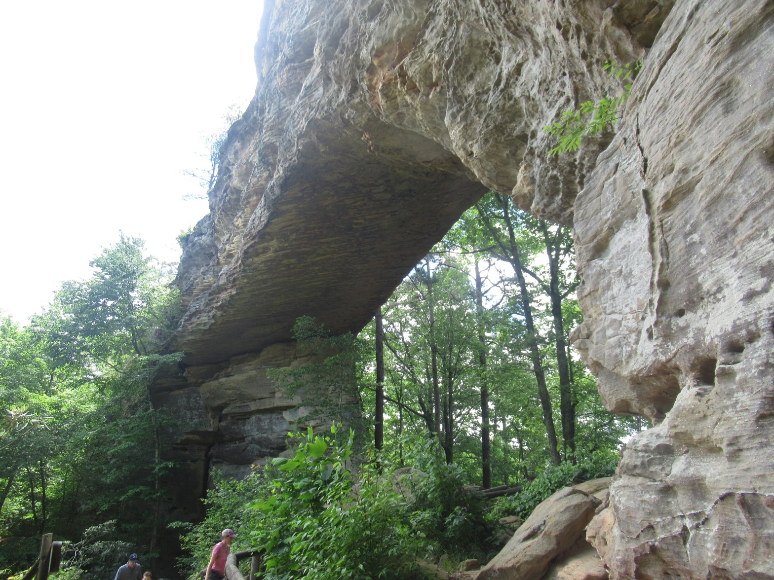
Natural Bridge State Resort Park is an amazing place situated on the south side of the Red River Gorge Geological Area in Slade, KY. Characterized by tall, steep cliffs and lush forests. It also has one of the area’s largest rock arches and numerous other interesting features. I was camping for the long Memorial Day weekend at Whittleton Campground here while hiking around this beautiful area.
Campsite #A40 at Wittleton Campground.The trailhead is just down the road from the campground.There’s a decent amount of parking at the trailhead.Trailhead entrance. Notice the left post of the railing also has the turtle logo, which designates this is also the Sheltowee Trace Trail, a 300 mile trail from north to south through Kentucky.Deutzia.Poison Ivy. Watch your step.Suspension bridge.Azalia.The Original Trail is just across the bridge.A rather poor map. I started on the northeast corner, and am now near the Gift Shop which is where the Original Trail begins. My destinations are Balanced Rock, Natural Bridge, Devil’s Gulch, and Laurel Ridge.Some info and warnings about the area.Be on the lookout around your feet.Getting started on the Original Trail.Bishop’s Cap.Snakeskin Liverwort.The Original Trail is nice.The trail to the left, I thought was the Balanced Rock Trail, which it is not. There is no sign, but it actually goes toward the Nature Center.Still too early for Rhododendrons.In the Nature Center now. Owls.They used to mine Niter here, a main ingredient to gunpowder.Info about how the Natural Bridge was formed.This tree is not REALLY old, but it’s seen some interesting history.Black Bear.White Tailed Deer.Ruffled Grouse and Bobcat.Grey and Red Foxes.Cooper’s and Red Tailed Hawks.Mountain Lion’s are no longer found here, but once roamed the area.About the railroad history here.Wild Turkey and Grey Squirrel.I found the Balanced Rock Trail.Cool cave.It’s pretty deep.Water drips from the overhang.The cave is blocked to protect bats.One thing I noticed, is that the rock here is limestone, which I thought was odd as most of the rock in this region is sandstone.There is an underground river here. You can here it rushing through this crack.The trail conitnues.Now the rock is sandstone.And the cliffs are tall.Cool weathering on the large sandstone slump blocks.Hemlock and Birch often cling to the cliffs.Balanced Rock.A better view of Balanced Rock.This trail is tough, but it’s beautiful.The colors and textures are amazing.The stairs on this trail are intense and seem to never end.Looking down this awesome staircase.Some of the stairs are more natural looking.And some of the drop-offs are tall.This trail climbs 400 feet over 3/4 mile.Partridge Berry flowers are in pairs and the pair combines to form a single fruit.More cool rocks.I saw this flower. I’m not sure what it is.The cliffs are incredible.Bad picture, but cool lichen.Wild Blueberries.Lots of Rhododendron.Unbrella Magnolia.Mountain Laurel.The Sheltowee Trace Trail(see the turtle sign) splits off to the left here.Finally reaching the top.This shelter was built in the 1930’s by the Civilian Conservation Corps.The end of the Balanced Rock Trail at the Natural Bridge.The top of Natural Bridge.This side trail goes down to underneath the bridge.Battleship Rock, and some potential storm clouds.There’s people on Battleship Rock.You can see a blooming Umbrella Magnolia tree down there.I zoomed way in. These flowers are the size of a dinner plate.I’m not sure what this flower is.The clouds are worrying me a little.I took the stairs down and there is this tight squeeze.You can see the tight trail.Underneath Natural Bridge.It’s a very large stone arch.It’s a wonder.Here’s a panorama.One more view of the arch.I took the Battleship Rock Trail.The cliff is colorful.And full of holes.This skink scared me. I thought it was a snake.More of those red flowers. Maybe some type of Catchfly.My hiking sticks for size comparison on the Umbrella Magnolia leaves.A connector to the Orignal Trail.The cliff seems to go on forever.The trail to the left takes you to the top of the cliff through a crevasse.Unfortunately, the stairs are being repaired and it’s closed.Cool tree roots.There are some small arches in the cliff.Here’s a closer view of one.I really had to search to find this trail.It ascends the cliff through a narrow crevasse.There’s a small cave near the top.I made it to the top and found the Laurel Ridge Trail. But before taking it left, I went right towards Lover’s Leap.Another cool lizzard.Lover’s Leap is an amazing view.Cool rock pillar.The drop off from here is very high.Looking toward Red River Gorge Geological Area.A wide angle view.My campground is down there.You can see Miguel’s Campground from the vista. The famous pizza place is just to the left behind the trees.I returned along the Laurel Ridge Trail.That is the suspension bridge where I started.The views from Battleship Rock are also intense.The view of Natural Bridge from Battleship Rock.The people on top give some size perspective.The Skylift can take you from the bottom to the top of Laurel Ridge.It’s like a ski resort lift.It looks fun.One more view from the top of Natural Bridge toward Battleship Rock.I went back down through the squeeze and caught the Original Trail.One more look back at the Natural Bridge.The Original Trail descends the gorge back toward the lodge.I think this is the connector I saw earlier on the Battleship Rock Trail.There are several of these small shelters along the Original Trail. I stopped at this one just as the clouds burst open.Don’t throw your trash into the woods.Yes, that is a DIRTY diaper.The storm only lasted 20 minutes. There were a couple of large fallen trees along this trailThis one landed across the trail.The Original Trail has several interesting educational signs.This looks like a sinkhole or an old mine entrance.The entrance is blocked off, but it looks like there is a cave there.The Civilian Conservation Corps, in the 1930’s, built lots of parks, roads, shelters, and trails.Cool roots.I can’t imagine what it took to build the stairs. The stones are huge.Poor picture, but some history of the logging in the area.In fact it was the logging companies who created this park.Back down closer to the end of the trail.Bladder Nut seeds.Some baby Canadian Geese.The Gift Shop has some good information on the park.About the creation of the park.One of the original Kentucky State Parks.The logging industry in the area.The early days of the resort.It looks a lot more natural today.Heading back across the suspension bridge.That is the lodge up on the hill.Red-Eared Slider, similar to a Painted Turtle.Some more babies.Made it back to camp for a nice evening by the fire with my buddy Wes joining me for a big hike tomorrow.







Leave a Reply