Date: 03/01/2020 – Distance: 10.3 mi – Elapsed Time: 6.5 hr – Ascent: 1007 ft – Descent: 1017 ft – Difficulty: Hard
I have been to this place numerous times (1, 2). This time I was here to scope out the spring wildflower situation. I was a little early, but managed a big hike and got to see the progress on the new South Gorge Bridge which should be completed shortly.
I parked at the North Rim Trailhead parking area in the main picnic area of John Bryan State Park. From there I first headed down toward the South Shelter area to see if that trail would allow me to get a look at the bridge construction from that side, however the trail was closed do to heavy construction and I had to hike back up the hill to where I started. I took the North Rim Trail to the John L Rich Trail and down to the North Bridge. I then approached the South Bridge from the other side along the Pittsburg-Cincinnati Stagecoach Trail. Then I returned to the North Bridge, where I continued along the trail, now called the John. L Rich Trail, and up the stairs to the Clifton Gorge Nature Center at the top of the gorge. Then I followed the Narrows Trail all the way to Clifton, then back to the Nature Center. I then went down the stairs into Clifton Gorge and proceeded to the North Bridge again, where I again hiked up the John L Rich Trail to the North Rim and returned to the parking area.
Sharp curve on road leading to the South Shelter area. This road is closed at the top.
Pittsburg-Cincinnati Stagecoach Trail closed from the west end. I like to obey rules.
While on the North Rim, I scoped out each of the rappelling sites. This is the red one.
Blue rappelling site.
North Rim Overlook.
Green Rappelling Area.
Waterfall along the North Rim Trail.
Pink Rappelling Area.
Another anchor for the Pink Rappelling Area.
Black Rappelling Area.
Good view from the Black Rappelling Area.
There actually is an access trail to below the Black Rappelling Area.
Yellow Rappelling Area.
Another rappelling access trail.
This is what is under the Yellow Rappelling Area.
Quite an overhang.
This is on the descent to the North Bridge.
North Bridge.
The North Bridge area is a great place.
During the summer you can’t see the other cliff.
Following the Pittsburg-Cincinnati Stagecoach Trail now.
I have never noticed this rock balanced on top of the slanted slump block.
There’s enough room for a person underneath, or a large animal.
This is last year’s leaves on a Sharp-Lobed Hepatica. It will bloom in the next few weeks, then send up new leaves.
Another animal shelter.
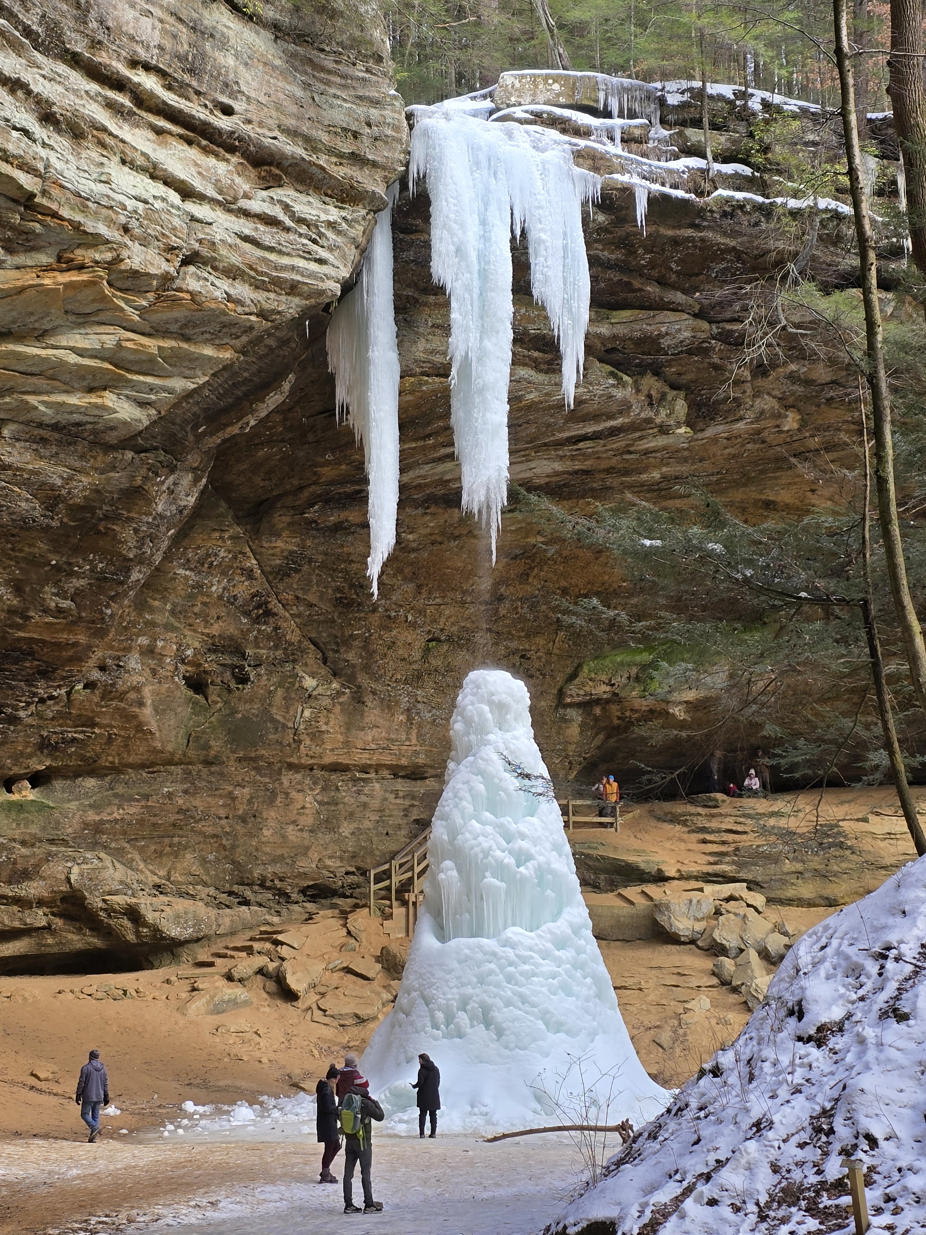
This is the waterfall I saw from above earlier.
This spot if really popular with fishermen.
Approaching the South Bridge from the other side.
The new bridge is coming along nicely.
Rappelling Area.
Maybe a caddisfly?
Now I’m in Clifton Gorge State Nature Preserve.
Clifton Gorge is one of my favorite areas in the state.
This section of the trail has a lot of Hepatica.
It really like the limestone/magnesium rich dolomite rock.
Steamboat Rock. There used to be a paper mill on this site.
Looking back at Steamboat Rock. The trail on the right used to be an access road for the mill.
This waterfall is pretty intense. The boardwalk trail meanders around some slump rocks below the falls.
This is a bridge over a falls along the Narrows Trail east of the Nature Center.
This feeds the waterfall. The bridge is SR 343 between Clifton and Yellow Springs.
There are some cedars here.
One of my favorite part of the Narrows. You can feel the power of the rushing water.
Incidentally this is the same river as below. Looks totally different. Really speaks to why there historically were so many mills in this gorge. I think 7 at one time.
Those holes in the flat part of the rock are old post holes for a textile mill on this location called Patterson Mill.
Some newly laid trail maintenance.
CCC stands for Civilian Conservation Corps. They build many state park structures across the country during the depression.
Now I’ve returned to the gorge below the Nature Center on the John L. Rich Trail..
Looking back, this is a better image of the boardwalk around the slump rocks at the falls.


Leave a Reply