


Date: 08/04/2019 – Distance: 6.2 mi – Elapsed Time: 4.0 hr – Ascent: 594 ft – Descent: 607 ft – Difficulty: Medium
After spending the night in John Bryan Campground on Sat 8/3/2019, I woke up and had some breakfast. I was going to brew some coffee in my JetBoil, but decided to hike to Yellow Springs instead. To do this, I was able to hike through the Glen Helen Nature Preserve, a 1000 acre, privately owned park, run by Antioch College, with over 20 miles of pristine trails.
I entered the park from John Bryan on the south east corner however if you want to drive to Glen Helen Nature Preserve you can follow these directions. From Columbus, take 70 West to US 68 just past Springfield. Take US 68 south about 7 miles to Yellow Springs. Turn left on Corry Street, which follows along the Little Miami Scenic Trail bike path. The main entrance to Glen Helen is on the left about 0.4 miles. There is a small fee to park here but it all goes to support the park.

I first exited the campground on the maintence road on the south west corner, I took the service road out to Bryan Park Road. I turned left and just a short hike turned right at a closed service gate into Glen Helen Nature Preserve where a sign is posted.
Glen Helen trails are not marked very well. A good map is a must. I have a handheld Garmin GPSMAP 64s. On this I have loaded the 24k topos, satellite imagery, and trail routes downloaded from alltrails.com. I was going to follow the trail called the Glen Helen Multi-Trail Loop(Alltrails). I started going clockwise but soon found that trail very overgrown and hard to follow. So I decided to reverse and do the trail counterclockwise as that part seemed much more maintained.
The trail I started on is called the Fire Road although it’s not labelled as such. It travels along the east side of the preserve and eventually arrives at the Outdoor Education Area(closed to the public) on the northeast corner of the park. About 3/4 of a mile and at the fourth left intersecting trail, I arrived at the Upper Birch Creek Trail. It is not labelled either.
The Upper Birch Trail is a little narrow at first but soon widens out. It traverses the rim of the eastern cliff of the Yellow Springs and Birch Creeks. It’s a good scenic section of trail with many spectacular slump rocks which have fallen away to the left. I followed this trail about a mile staying straight at all intersecting trails following along the cliff rim.

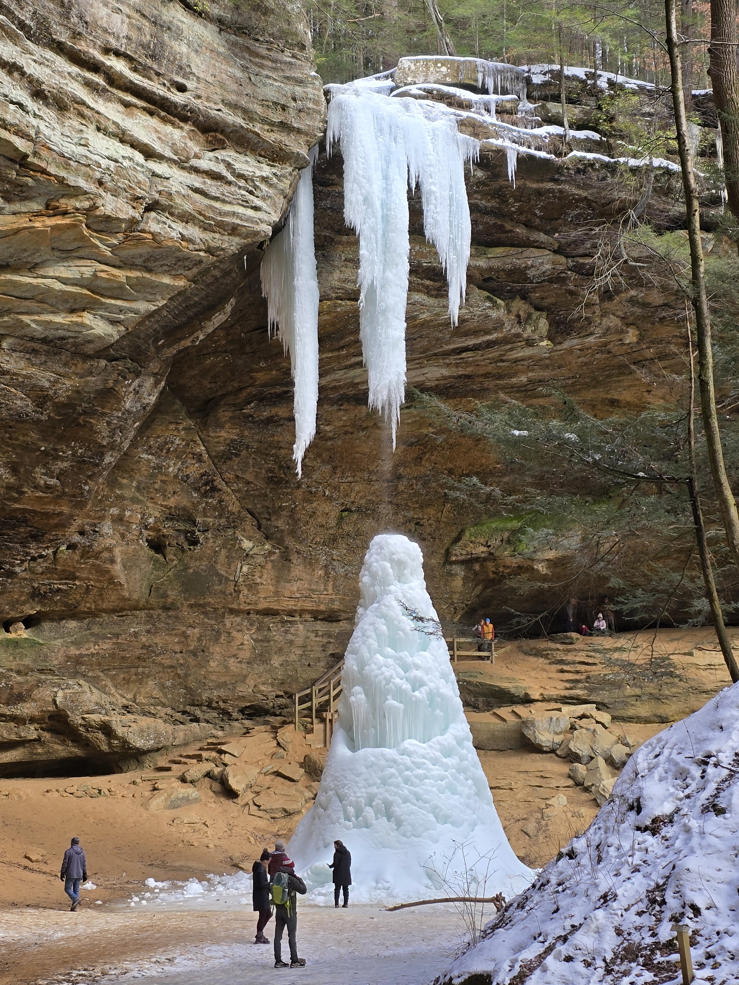
Eventually the trail starts to decend at a small intersecting stream toward a waterfall called The Cascades.


There is a footbridge over the top of the falls with a dramatic view of a deep pool below the main falls. On the other side of the bridge is the Inman Trail.
The Inman Trail is a loop and goes straight or left along the east cliff of Birch Creek. I will do this trail another time as it looks like there are several sights along it. Coffee was calling me, so i took the trail along the cliff. On this side of the creek, it follows below the cliff for another dramatic view. Shortly after entering the trail there is a left which leads to a beautiful view of the falls from under the cliffs.

The Inman Trail, at about a third of a mile, intersects the Lower Birch Creek Trail at the valley floor. I turned right then shortly a left into a boggy area with a walkway though the wet parts. I crossed a footbridge over the Yellow Springs Creek to a rather daunting climb up a staircase which switch backs a couple times before arriving at the top. At the top is the main entrance to the park with the Trailside Museum and parking lot.
Just past the parking lot is the village of Yellow Springs and a bike trail called the Little Miami Scenic Trail. I took a right on the bike trail and followed it about a half mile to Route 68 in town. I took a left on 68(Xenia Ave), and shortly arrived at Dino’s Cappuccino(GPS below) where I got my quad espresso with cream and sugar over ice. I relaxed just outside on the street at a sidewalk table and enjoyed this eclectic town for a bit before heading back down the bike path back to the park entrance.
From here my original loop trail was supposed to take me down the Talus Trail along the west side of the park. The Talus trailhed is a small wooden sign in the grassy area just right before going down the steps and back into the valley. I soon discoverd the Talus trail was very overgrown and soon almost disappeared. So I backtracked to get my bearings and find an alternate route back.
I found that if I decended and caught the Lower Birch Trail, took it to the Sassafras Glove Trail, then catch the Pine Forest Trail it would take me back where I started at the Fire Road.

Altogether this hike was about 7 miles and I was back at the campsite by noon so I could pack up camp and checkout by 1.
Waypoints:
- John Bryan Campground #4 – N39° 47.283′ W83° 51.996′
- Fire Gate Entrance into Glen Helen from John Bryan State Park – N39° 47.252′ W83° 52.266′
- Bridge over Cascades Falls – N39° 48.224′ W83° 52.787′
- Cascade Falls Overlook – N39° 48.207′ W83° 52.800′
- Glen Helen Trailside Museum – N39° 48.056′ W83° 53.106′
- Dino’s Cappuccinos – 225 Xenia Ave, Yellow Springs, OH 45387-1832 – N39° 48.349′ W83° 53.325′
Links:


Leave a Reply