


Date: 12/01/2019 – Distance: 3.4 mi – Elapsed Time: 2.25 hr – Ascent: 525 ft – Descent: 512 ft – Difficulty: Medium

This was one of the cooler trails I did this weekend in this park. Aside from the 360 degree view of the park from the top of Morgan’s Knob, there is a deep ravine fed by three streams each with a waterfall and a couple caves and rock outcroppings.
The trailhead for the Morgan’s Knob Loop Trail begins at a parking area on Road 3, between the cabins (R-18) and the Sugartree Marina (R-67). There is another trail to the left of the trailhead for the Pine Crest Trail as well. The Morgan’s Knob Trail goes straight from the parking area into a thick pine grove and eventually forks off to the left at a small waterfall to continue the Loop Trail portion, which ends back where the Pine Crest Trail begins.

CAUTION: There is a mistake on the Waypoint Marker maps at Waypoint Marker W and it looks like the trail goes left and loops back around to where you started, but it doesn’t actually do that. The left fork is actually a horse trail and will take you way off course if you follow it. Luckily my GPS lead me to this conclusion and I was able to turn around and retrace my steps. You can see that on my track above where I wandered around before turning back. That loop actually leaves from Waypoint Marker V instead.

From the trailhead, you can go either way, but I took the straight path first. The pine grove here is very thick, but the trail is well defined. I believe they are Norway Spruce.


After leaving the pine grove, the trail turns more deciduous.

Soon you arrive at Waypoint Marker V and a sign for the Morgan’s Knob Loop Trail, which takes you back to the parking. I wanted to see Morgan’s Knob first so I continued straight.

Just a short distance more and you arrive at Waypoint Marker W which I cautioned above about. This is just a horse trail crossing. Continue straight to Morgan’s Knob.


When I returned down the trail from Morgan’s Knob, I wanted to do the Loop, so I mistakenly took a right at Waypoint Marker W. I have a GPS and I knew where the trail should be, and when it started veering away from where I needed to be, I decided that I was either on the wrong trail or the trail had become overgrown where I was supposed to turn. Later I realized I was on the horse trail. You can see the dotted line going south from point W on the following Waypoint Marker. If I had not known better, I would have ended up way off course.

However I did see some cool things on that horse trail.


When I back coming back on the horse trail, I noticed Waterfall 1, which is actually really near the Waterfall 2/Cave. These two small streams converge and create a larger stream which is what cut this deep ravine.

When I got back to Waypoint Marker W, I turned right and continued to Waypoint Marker V, where the sign is labelled Morgan’s Knob Loop Trail. I followed that fork, and got a closer look at Waterfall 1, but couldn’t get a front view like I had from the other side of the ravine.


Continuing along the loop portion of the trail, I came to some cool outcroppings, right before the trail turned left.


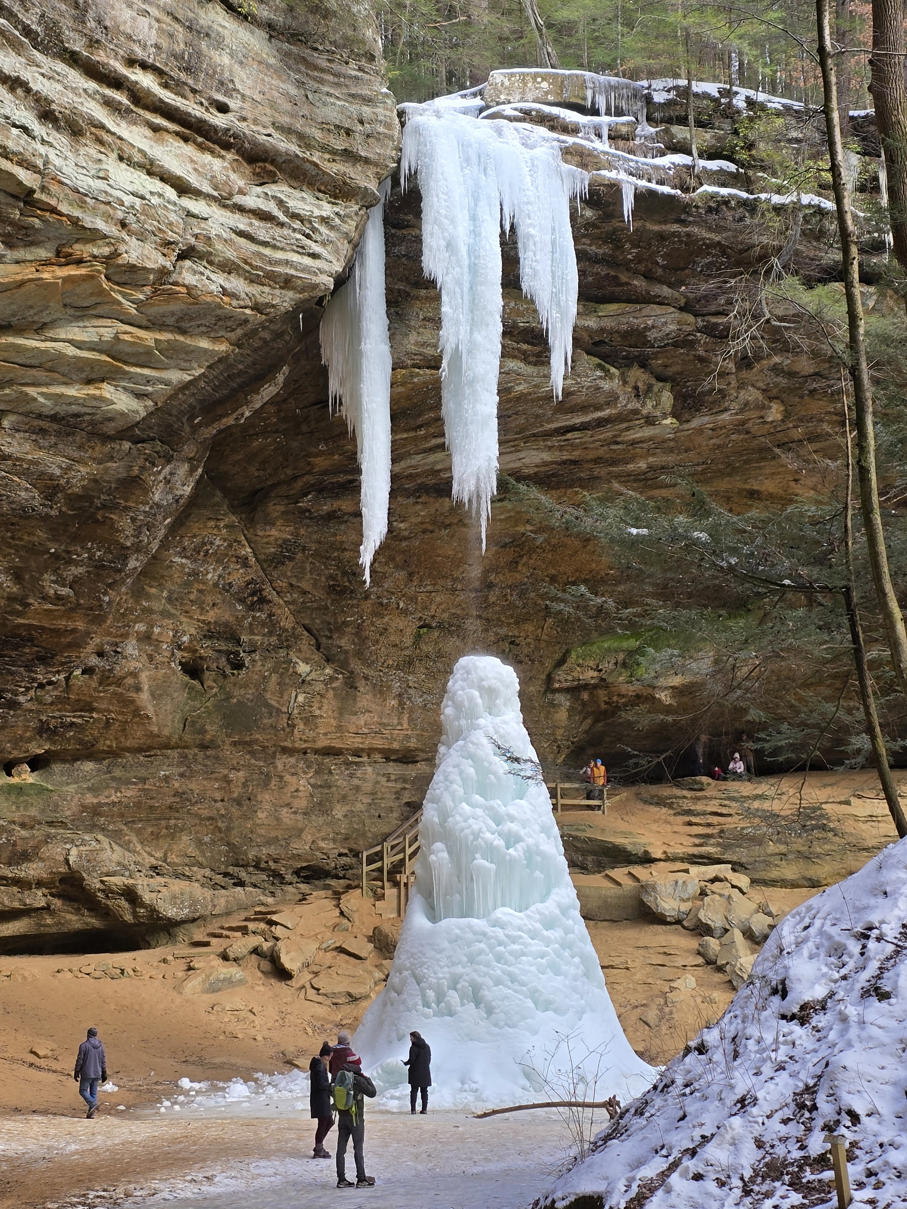
After the rocks above and the trail turned left, I saw Waterfall 3. It was bigger than the others.


The trail actually wraps around right to the top of this waterfall, then ends back at the parking area.


Waypoints:
- Trailhead Parking – N40° 06.978′ W81° 31.561′
- Morgan’s Knob – N40° 07.062′ W81° 31.988′
- Waterfall 1 (Waypoint V) – N40° 07.137′ W81° 31.823′
- Waterfall 2/Cave – N40° 07.099′ W81° 31.846′
- Waterfall 3 – N40° 07.036′ W81° 31.631′
Links:


Leave a Reply